There are three methods available to calculate the feature location.Least Squares - Local Coordinate System (Ls LCS)
|
|
Within this Section: Local Coordinate System Ls LCS for Planar Features Ls LCS for Cylindrical Features Average Plane/Axis Calculation Ls High Point LCS Nominal - High Point LCS |
See Also...
|
Local Coordinate System (LCS) - Move logic for GD&T and Feature Move:
•The primary plane is one flat plane through the plane point. The normal vector of the primary plane is the plane direction.
•The secondary plane is one plane perpendicular to the primary plane through the plane point of the secondary locating surface.
•The tertiary plane is one plane perpendicular to the primary and secondary planes through the plane point on the tertiary locating surface.
•If only a primary surface is selected, the secondary and tertiary planes are created through the plane point on the primary plane.
•The Plane Direction is the vector normal to the plane. If the DRF consists of two surfaces for a locating surface, the plane direction is the average of the plane direction of each feature. If the DRF consists of two surfaces for a locating surface, the plane point is the average of the plane point of each surface.
Default (setting)
•Default Feature Move and GD&T setting to use the Preference setting. If the Plane Calculation changed in the Preferences, all Feature Moves and GD&T set with Default will use the Preferences setting. Each Feature Move and GD&T can independently be set to a different Calculation Method.
Least Squares calculation for Planar Features
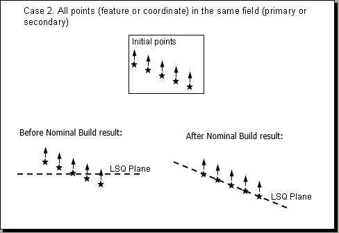
When using Planar Features, 3DCS will create a plane based on the average of the deviated points.

Geometric Center: Least Square Geometric Center Plane - This method creates a plane based on the least square calculations. The Plane Point is the average of all the points (geometric center).

Least Squares calculation for Cylindrical Features
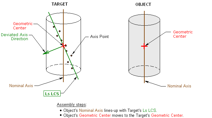
This method identifies the center of the axis created based on the least squares calculations, and locates the center of the Object axis to the center of the Target axis, aligning the two axes.

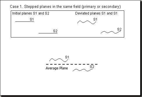
When using Planar or Cylindrical features that are stepped, 3DCS will calculate a plane or axis, based on the average (middle) of the Planes or Axis.


High-Point Least Square Calculation for Features, Locate Coordinate System Calculation for location. This method creates a plane based on the least square calculations. Then translates the plane to the highest point.

Nominal - High Point:
High Point Form-Plane (or axis) Calculation for Features, Locate Coordinate System Calculation for location. This method creates a plane parallel to the nominal surface through the highest point.
